
Ranch Mapper — map your fields in 3D.
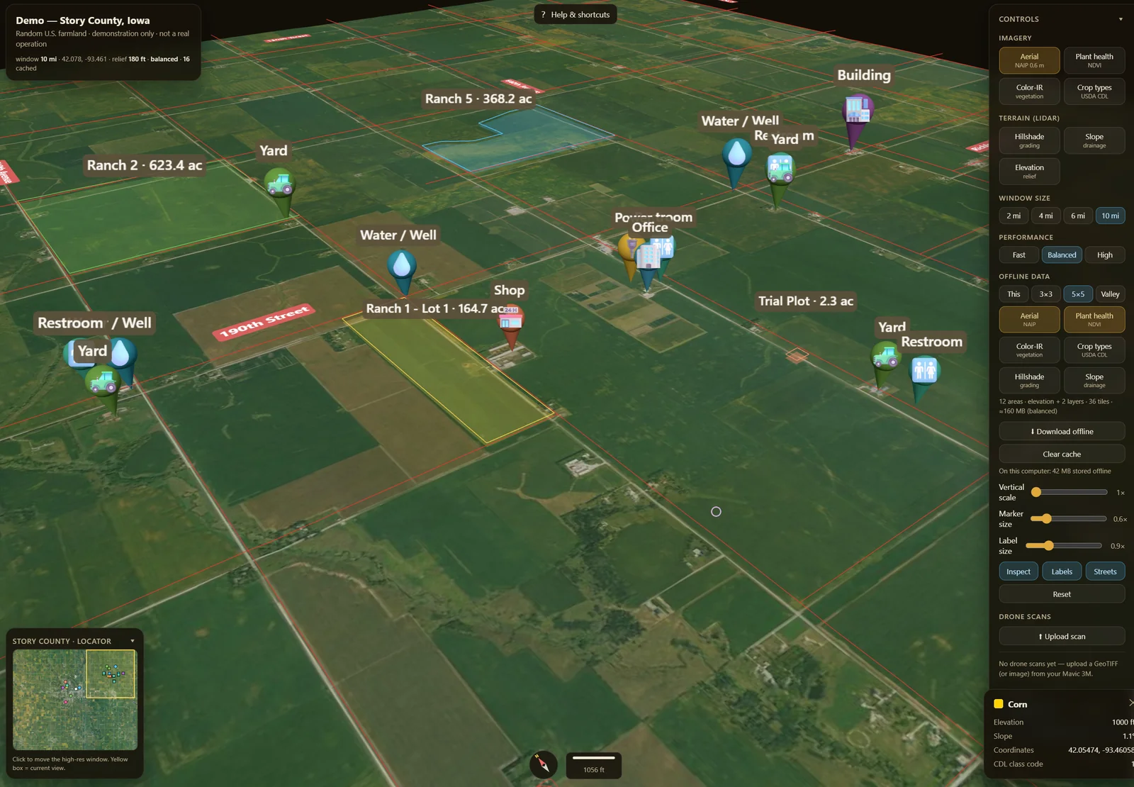
Map, measure, and annotate your fields in 3D on real lidar terrain and aerial imagery — outline ranches and lots, measure acreage — the standard map acre — track yields by season, and keep it all synced across phone and laptop, even offline in the field. No GIS software required.
What you can do
- 3D field maps on real USGS lidar terrain + aerial imagery, with slope, drainage, and elevation context.
- Draw & measure ranches and lots → instant acreage, perimeter, and elevation/drainage profiles, plus markers for wells, gates, and shops.
- Yield tracking — log estimates and post-harvest actuals per field by crop and pack type, then export CSV / GeoJSON or a printable operation report for FSA, insurance, and landlord paperwork.
- Import what you have — bring field boundaries in from KML, KMZ, or Shapefile (.zip). (Drone ortho overlays are on the way.)
- Works offline in the field (installable PWA on cached areas) and syncs across phone, tablet, and desktop.
- Precision-ag toolkit (beta) — AR field view, variable-rate prescription maps, cut/fill earthworks, drainage planning, as-applied coverage, and yield forecasting.
Who it's for
Row-crop, ranch & grazing, orchard, and produce operations — growers, ranchers, and ag operators / PCAs / crop consultants who need to lay out fields, track acreage, and document what's where, anywhere in the US. One-click starter sets and a simple mode fit it to your operation.
Planning beyond the lot?
Open FieldForge Pacific Signal for source-linked ENSO monitoring, official seasonal outlooks, current drought context, and an on-demand 72-hour NWS field-weather check. It keeps seasonal context separate from field-level records and advice.
Open Pacific Signal → (opens in a new tab)Pricing
Free while it's in beta — every feature unlocked, no field limit today. No credit card, no sign-up needed to start.
Monthly plans are coming: Pro at $19/month for one person and Operation at $49/month for five people including the owner. Checkout is not open yet. See the plans and join the launch list.
Open the Ranch Mapper
Loads instantly in your browser — start outlining a field in under a minute.
Open the mapper → (opens in a new tab)