Ranch Mapper — map your fields in 3D.
Map, measure, and annotate your fields in 3D on real lidar terrain and aerial imagery — outline ranches and lots, get instant acreage and drainage, see what's planted, and keep it all synced across phone and laptop, even offline in the field. No GIS software required.
Open the mapper
Free while in beta — no sign-up to start.
What you can do
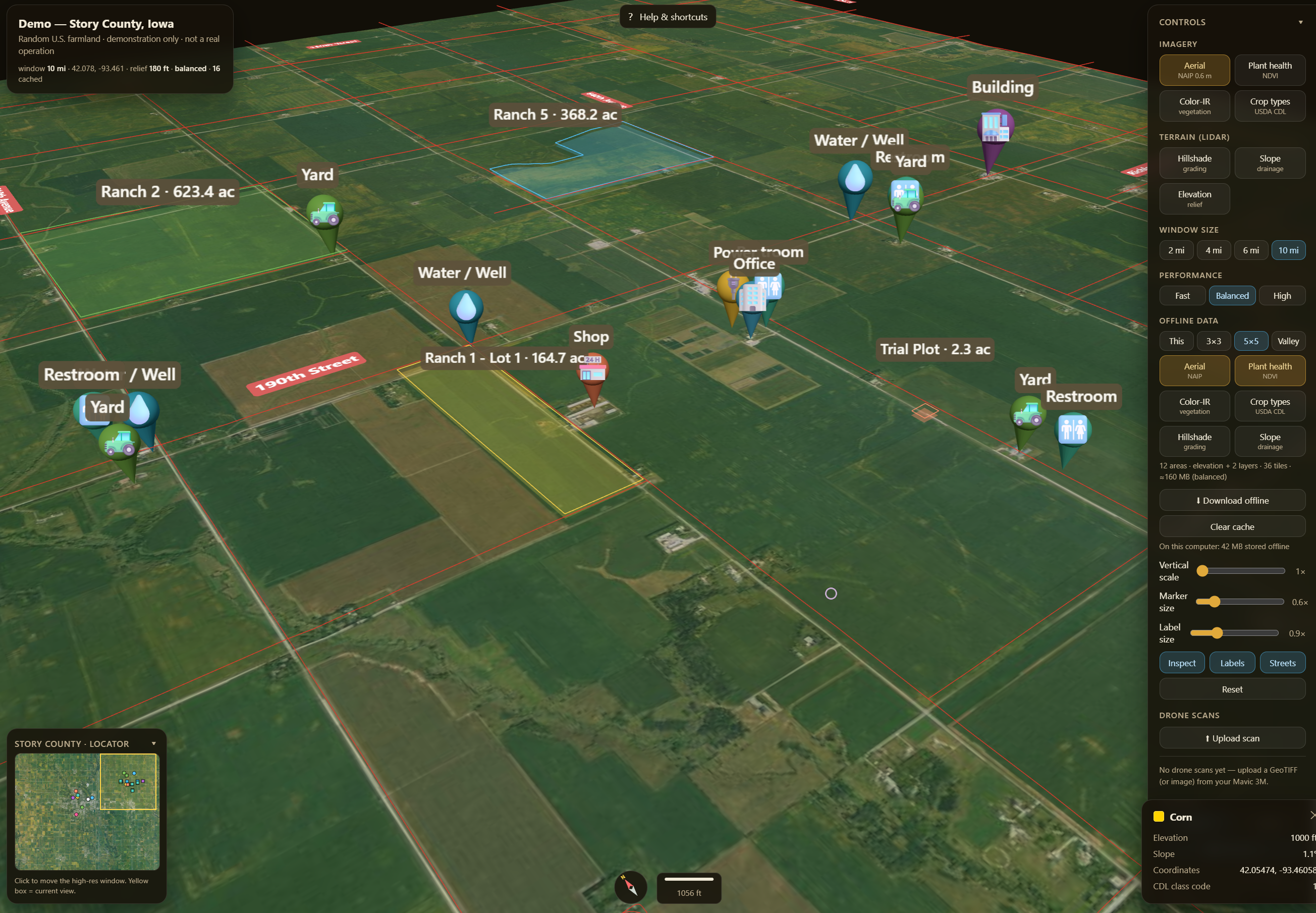
- 3D field maps on real USGS lidar terrain + aerial imagery, with plant-health, crop-type, and slope/drainage layers.
- Draw & measure ranches and lots → instant acreage, perimeter, and elevation/drainage profiles, plus markers for wells, gates, and shops.
- Auto crop detection fills in the dominant crop per field, with CSV / GeoJSON export for FSA, insurance, and landlord paperwork.
- Drone overlays — drape your DJI Mavic ortho scans onto the terrain; import your GPS field logs.
- Works offline in the field (installable app, download areas for no-signal) and syncs across phone and desktop.
Who it's for
Produce and row-crop growers, ranchers, and ag operators / PCAs / crop consultants who need to lay out fields, track acreage, and document what's where — anywhere in the US.
Pricing
Free while it's in beta — everything's unlocked, and there's no sign-up required to start drawing. Paid plans are coming; we'll announce them here first.
Open the Ranch Mapper
Loads instantly in your browser — start outlining a field in under a minute.
Open the mapper →